Show the map
Course des Cascades de l'Alloix 2018 - 13 km
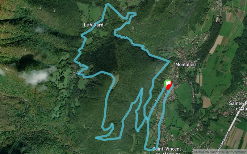


13.1 km
810 m
810 m
 Saint-Vincent-de-Mercuze (38)
 Points of Interest table
| Accum. | Intermediary | |||||||
|---|---|---|---|---|---|---|---|---|
| POI | Description | Alt. | Dist. | D+ | D- | Dist. | D+ | D- |
 Competition organized on 04/22/2018
Trace n°52303
Ascent threshold : 3 m Distance threshold : 30 m Smoothing : Yes Origin of altitudes : MNT Aster GDEM
Ascent threshold : 3 m Distance threshold : 30 m Smoothing : Yes Origin of altitudes : MNT Aster GDEM
Loop
Dominant terrain : Footpath
Max alti. : 950 m
Avg alti. : 600 m
Min alti. : 343 m
Longest ascent : 290 m
Longest descent : 390 m
Dominant terrain : Footpath
Max alti. : 950 m
Avg alti. : 600 m
Min alti. : 343 m
Longest ascent : 290 m
Longest descent : 390 m
Elevation profile
More tools
Create a new roadbook page
Map and track on your website
Warning ! When you insert a Trace de Trail map on your website, you agree not to hide any element of the module (links to Trail Trail or Trail Connect banner)
Add a realisation
Validate
Add a realisation to share your chrono and describe the conditions that you encountered during you trail running !
Add a comment
Validate
frederic_digard
07/02/18, 16:02:32
Une belle course dans les gorges de l'Alloix sur le Chemin d'Autrefois, et profiter de la vue sur Belledonne... avec en prime le Mont Blanc ;-). Un parcours original et atypique, varié en difficulté et accessible pour découvrir l'esprit Trail... même pas peur ! ! Départ le Samedi 22 Avril 2018 à 9h30 - 13 km 800m+/- (Départ commun avec le 21 km)
Show the infos
Add a track