Show the map
Le Thuit - Bois Hubert - Connelles - Amfreville-sous-les-Monts
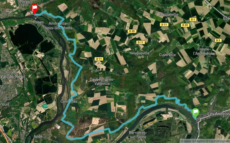


29.8 km
1030 m
1030 m
 Les Andelys (27)
 Poses (27)
 Points of Interest table
| Accum. | Intermediary | |||||||
|---|---|---|---|---|---|---|---|---|
| POI | Description | Alt. | Dist. | D+ | D- | Dist. | D+ | D- |
Trace n°42953
Ascent threshold : 3 m Distance threshold : 30 m Smoothing : Yes Origin of altitudes : MNT IGN
Ascent threshold : 3 m Distance threshold : 30 m Smoothing : Yes Origin of altitudes : MNT IGN
Crossing
Dominant terrain : Footpath
Max alti. : 145 m
Avg alti. : 69 m
Min alti. : 9 m
Longest ascent : 140 m
Longest descent : 120 m
Route completed by the author : Yes
Dominant terrain : Footpath
Max alti. : 145 m
Avg alti. : 69 m
Min alti. : 9 m
Longest ascent : 140 m
Longest descent : 120 m
Route completed by the author : Yes
Elevation profile
More tools
Create a new roadbook page
Map and track on your website
Warning ! When you insert a Trace de Trail map on your website, you agree not to hide any element of the module (links to Trail Trail or Trail Connect banner)
Add a realisation
Validate
Add a realisation to share your chrono and describe the conditions that you encountered during you trail running !
Add a comment
Validate
Admin - Trace de Trail
28/06/20, 21:47:42
En France, il faut privilégier le MNT IGN qui donne de meilleurs résultats...
28/06/20, 21:47:42
En France, il faut privilégier le MNT IGN qui donne de meilleurs résultats...
Show the infos
Add a track