Show the map
Trail de la Côte d'Albatre
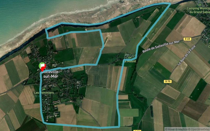


 Sotteville-sur-Mer (76)
 Points of Interest table
| Accum. | Intermediary | |||||||
|---|---|---|---|---|---|---|---|---|
| POI | Description | Alt. | Dist. | D+ | D- | Dist. | D+ | D- |
 Competition organized on 11/04/2012
Trace n°346
Ascent threshold : 0 m Distance threshold : 35 m Smoothing : Yes Origin of altitudes : MNT Aster GDEM
Ascent threshold : 0 m Distance threshold : 35 m Smoothing : Yes Origin of altitudes : MNT Aster GDEM
Loop
Dominant terrain : Footpath
Max alti. : 50 m
Avg alti. : 31 m
Min alti. : 5 m
Longest ascent : 66 m
Longest descent : 37 m
Dominant terrain : Footpath
Max alti. : 50 m
Avg alti. : 31 m
Min alti. : 5 m
Longest ascent : 66 m
Longest descent : 37 m
Elevation profile
More tools
Create a new roadbook page
Map and track on your website
Warning ! When you insert a Trace de Trail map on your website, you agree not to hide any element of the module (links to Trail Trail or Trail Connect banner)
Add a realisation
Validate
Add a realisation to share your chrono and describe the conditions that you encountered during you trail running !
Add a comment
Validate
Admin - Trace de Trail
29/03/13, 16:09:17
Effectivement, pour le ravitaillement en eau, il y a de quoi faire ! un peu salée peut-être...
29/03/13, 16:09:17
Effectivement, pour le ravitaillement en eau, il y a de quoi faire !
Show the infos
Add a track