Show the map
Brotschberg - Geissfels - Schlossberg - Grand Geroldseck
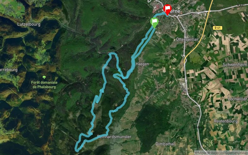


29.4 km
1270 m
1320 m
 Saverne (67)
 Saverne (67)
 Points of Interest table
| Accum. | Intermediary | |||||||
|---|---|---|---|---|---|---|---|---|
| POI | Description | Alt. | Dist. | D+ | D- | Dist. | D+ | D- |
Trace n°80268
Ascent threshold : 3 m Distance threshold : 30 m Smoothing : Yes Origin of altitudes : MNT IGN
Ascent threshold : 3 m Distance threshold : 30 m Smoothing : Yes Origin of altitudes : MNT IGN
Crossing
Dominant terrain : Footpath
Max alti. : 609 m
Avg alti. : 427 m
Min alti. : 195 m
Longest ascent : 330 m
Longest descent : 340 m
Route completed by the author : Yes
Dominant terrain : Footpath
Max alti. : 609 m
Avg alti. : 427 m
Min alti. : 195 m
Longest ascent : 330 m
Longest descent : 340 m
Route completed by the author : Yes
Elevation profile
More tools
Create a new roadbook page
Map and track on your website
Warning ! When you insert a Trace de Trail map on your website, you agree not to hide any element of the module (links to Trail Trail or Trail Connect banner)
Add a realisation
Validate
Add a realisation to share your chrono and describe the conditions that you encountered during you trail running !
Add a comment
Validate
Admin - Trace de Trail
22/11/19, 05:41:36
Bonjour, en France, il faut utiliser le MNT IGN pour le calcul du profil alti... on obtient alors 1270m de dénivelé positif.
22/11/19, 05:41:36
Bonjour, en France, il faut utiliser le MNT IGN pour le calcul du profil alti... on obtient alors 1270m de dénivelé positif.
gillou57
21/11/19, 23:05:07
Beau tracé que j'ai suivi à la lettre, cela dit le D+ est complétement faux, sur la montre et Strava après l'activité, j'arrive à 1230D+ pas 2040D+ comme annoncé.
21/11/19, 23:05:07
Beau tracé que j'ai suivi à la lettre, cela dit le D+ est complétement faux, sur la montre et Strava après l'activité, j'arrive à 1230D+ pas 2040D+ comme annoncé.
Show the infos
Add a track